- Oscilloscopes[2]
- Navigation & GPS[4]
- Other Marine Supplies[2]
- Level Measuring Instruments[10]
- Other Measuring & Analysing Instruments[2]
- Theodolites[7]
- Other Optics Instruments[1]
- Antennas for Communications[3]
- Laser Levels[7]
- Other Electrical Instruments[2]
- Other Measuring & Gauging Tools[1]
- Prisms[1]
- Other Electronic Components[2]
- Instrument Parts & Accessories[1]
- Chargers[1]
- Measuring & Analysing Instrument Processing Services[1]
- Connectors[7]
- Testing Equipment[1]
- Gas Analyzers[1]
- Alarm[1]
- Contact Person : Mr. yang yuesan
- Company Name : Shanghai Galaxy International Trade Co., Ltd.
- Tel : 0086-21-64392351
- Fax : 0086-21-51685021
- Address : Shanghai,Shanghai,Rm.1206, Aijian No.1 Building, South of Wanping Road 590#
- Country/Region : China
- Zip : 200030
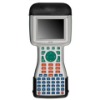
LT200 Series professional GIS Data Collector System
CHC LT200 Series professional GIS Data Collector System is ease of use with numeric and alphabetic keyboard, and ease of operation with clear function module. The LT200 series are packaged with professional GIS software, widely used in the applications of Surveying, Topography, Land Property, Power, Petroleum, Geology, Mining, Forest, Agriculture, ect. , additionally, the GIS software could be functionally developed according to different customer requirements. |
Features |
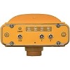
Various Solutions CHC GIS system provides the user various GIS solutions 1 Wide Area Augmentation System solution, 2 channels tracking SBAS (MSAS/EGNOS/WAAS) signal, meter level accuracy. 2 Real Time Differential (RTD) solution makes sub-meter accuracy. 3 Post-Processing Kinematics solution increases the accuracy and reliability. 4 Static solution with external GPS antenna realizes the centimetre level accuracy. Professional Application Software CHC developed GIS data collection software LandTour and Post-processed software LandTourOffice, meeting various industrial requirements. The software is compatible with major GIS system as MapGIS/Mapinfo/ArcGIS/SuperMap, and also CHC can customize it based on different industrial requirements. Numeric and Alphabetic keyboard LT200 Series GIS data collector uses numeric and alphabetic keyboard, supporting combined key pressing and Keyboard compatible with PC keyboard. The keyboard makes the inputs much more convenient and efficient. Professional GIS Field Work Design CHC LT200 is designed as rugged industry field devices with waterproof, dustproof and anti-shock. The battery of GIS collector lasts 12 hours, meeting the requirement of whole day field work. |
Technical Parameters |
System Configuration Operation System : Windows CE.NET 6.0 Processor: 634MHz Marvell PXA310 Processor Internal Memory: 256MB External Memory: TF Card Slot, up to 16GB Data Communication Built-in Bluetooth Class 2, version 2.0+ EDR protocol High-speed USB 2.0 port 9 pin RS232 serial port Power Supply 4800mAh 3.7V rechargeable Li-on Battery 9-16V DC external power supply available Display Screen VGA-TFT 3.7" colored touch screen 640X480 pixel resolution LED backlight Alphabetic and numerical keyboard Physical Specification Working Temperature: -30 - +65 Storage Temperature: -40 - +75 Waterproof and Dustproof: IP65 Shock and Vibration: Survive from 1 meter drop onto concretes GPS Positioning Specification 12 channels, L1 only, including 2 SBAS channels SBAS real time accuracy: <3m RTD accuracy: <1m PPK accuracy Fix Solution: Horizontal: +(10cm+1ppm) RMS Vertical:+(20cm+1ppm) RMS Static accuracy: Horizontal:+ (5mm+1ppm) RMS Vertical: + (10+2ppm) RMS Baseline Length: 10km |
LT200 Series professional GIS Data Collector System


